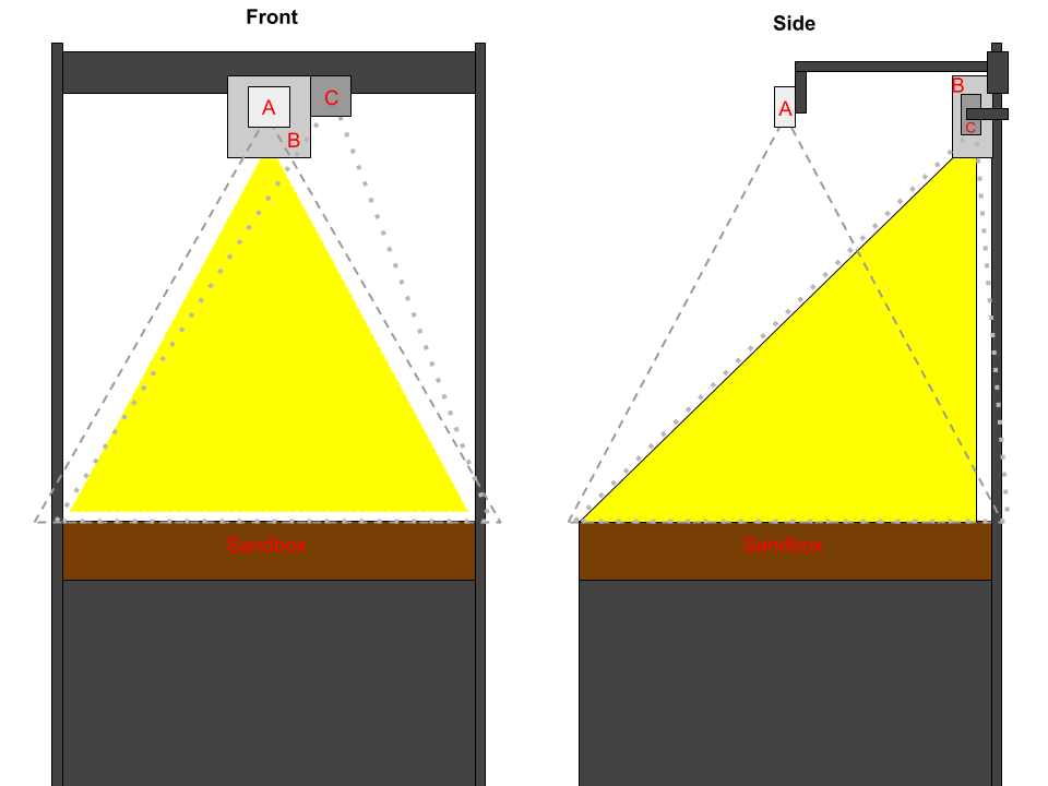
The sandtable examines the potential to detect, calculate and show elevation models on kinetic sand in real time. Kinetic sand is known for its ability to hold its shape and be molded into different forms. The Microsoft Azure Kinect can capture detailed 3D images and with our software, the elevation model of the sand is calculated and five layers (from rivers and lakes filled with fishes to snow-covered mountains) are shown directly as a projection on the kinetic sand.
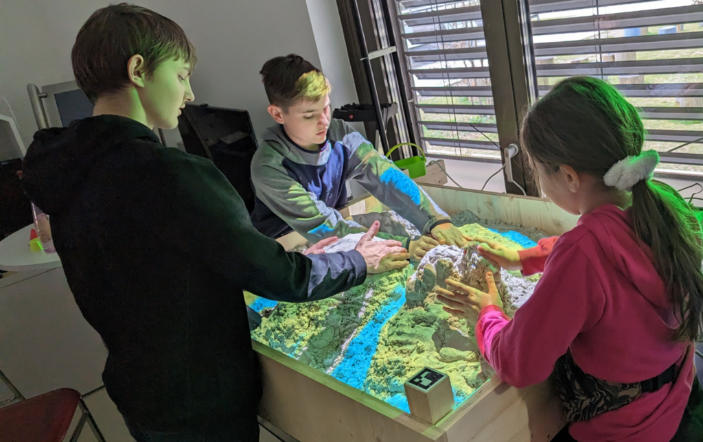
Depending on the measured biodiversity of the molded terrain a specific quantity of birds is flying over the sand, as well as a light scale indicates the biodiversity from 0 to 100 percent.
Another key feature of our development is the possibility to remote calibrate the challenging interplay between Microsoft Kinect Azure and the projection. Therefore, a calibration tool was developed, which allows fine adjustments of detection and projection with the help of a web cam and a remote access and remote-control computer software.